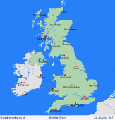
|
Issued: 0900 Friday 26th August 2022
Duty forecaster: Alexi Venerus
Largely dry, though cooler in the north and east next week
High pressure centres itself to the north of the country over the coming days seeing mostly dry weather though pulls in a cooler easterly wind. This may lead to a cloudier east with the best of the warmth and sunshine further west. Temperatures look to recover for all towards the end of the week, though lower pressure will bring mixed weather by the weekend.
For the weather for the next few days click here
 Bank Holiday Monday 29/8/22 Bank Holiday Monday 29/8/22
High pressure stays centred to the north of Scotland on Monday. A brisk easterly wind, originating from the far north, will keep the temperatures down in the north and east. Mostly dry with sunny spells, though showers looking to develop across west Scotland, northern parts of Ireland and Northern Ireland. Feeling cool in the north and east with highs here at 16 to 18C, warmer south and west at 20 to 24C.
 Tuesday 30/8/22 Tuesday 30/8/22
Most places again staying dry as high pressure sits to the north of the British Isles. Eastern areas seeing the risk of more cloud and possible drizzle where it is heavy. This will make it feel cool here again. Best of the sunny weather is further west where it should stay dry. Meanwhile there is a risk of some heavier, thundery showers pushing onto southern English coastal counties. Highs at a cool 15 or 16C in the north and east, 18 to 23C elsewhere.
Wednesday 31/8/22
Wednesday still sees the risk of some cloud and possible drizzle affecting some eastern coasts along with scattered heavier showers pestering some southern English counties pushing north across the Channel. Otherwise, dry and fine with sunny spells. Highs at 18 to 25C for most, though still cooler in the north and northeast.
Thursday 01/9/22
Thursday sees again a largely dry day and warmer for many, though there is still the risk of some cloud and drizzle pushing on to some easternmost counties. Also, the risk still there for scattered, heavier showers to affect some southern English counties. Otherwise another dry and sunny day. Highs at 18 to 26C.
Friday 02/9/22
With lower pressure moving closer towards Britain by Friday the weather will start to become more mixed with southern and western areas looking to see some rain, currently best of the drier weather will be further east. A warm and muggy day with highs at 19 to 27C.
Saturday 03/9/22
By the weekend lower pressure looks to bring more widespread unsettled weather. Cloud with outbreaks of rain towards the west bringing down temperatures here, while showers are expected in the south. Strengthened winds across more northern and eastern areas. Highs at 17C in the west and up to 27C in the southeast.
|
