|
Issued: 1000 Saturday 5th January 2018
Duty forecaster: Claire Darbinyan
The weather patterns affecting the British Isles will become increasingly unsettled through this week
The area of high pressure which has dominated our weather of late shows signs of being edged out by the return of a more westerly, unsettled weather pattern. It will cold at the start of the outlook period with northerly winds and wintry showers expected before a slightly milder westerly flow develops by the weekend.
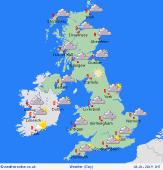
 For the weather for the next few days click here For the weather for the next few days click here
Tuesday 08/01/19
The area of low pressure passes into southern Norway on Tuesday as high pressure builds west of Ireland. This brings a strong and cold north to northwest flow across all parts of the country. Wintry showers in northern and eastern Scotland, with some affecting eastern coasts of England too. Tending to be brighter and drier to the west and south. A significant wind chill-developing. High temperatures at 5 to 8C.
 Wednesday 09/01/19 Wednesday 09/01/19
Low pressure to the east and high pressure over Ireland allows for another cold day. There is a risk of some wintry showers in East Anglia and southeast England, but most places should be dry. Some bright or sunny spells, although increasingly murky in western Scotland and parts of Ireland. Highs near 3 to 8C.
 Thursday 10/01/19 Thursday 10/01/19
High pressure remains dominant on Thursday, although a weak front brings some low cloud and drizzle into Scotland, northern England and Ireland first thing. Staying cold in the south of England, although becoming murky here with some lower cloud developing. A risk of further wintry showers in the southeast. High temperatures at 6 to 10C.
Friday 11/01/19
Despite high pressure being in control it might be a rather dull day on Friday. There could be drizzle over coasts and hills, especially in the north and west. Becoming increasingly windy through the day in the northwest too. The best of any brightness of central and southern areas. Highs at 7 to 10C.
Saturday 12/01/19
A more mixed day on Saturday with the return of westerly winds pushing fronts eastwards. These bringing showery outbreaks of rain, mostly in the west. Highs at 7 to 12C.
Sunday 13/01/19
A low pressure system to the north of Scotland brings strong winds and heavy rain to northern areas. Cloudy and windy but dry in the south. Highs at 7 to 11C.
|
