|
Issued: 0900 Saturday 22nd May 2018
Duty forecaster: Dr. Simon Keeling
Plenty of dry weather, an increasing easterly wind
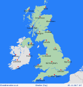
Plenty of dry weather for many parts of the UK and Ireland in the coming week. High pressure is going to be drifting north of Scotland with low pressure to the south. The winds turn to the east bringing cooler conditions to eastern coasts and the best of the sunshine in the west. Warmer away fro the coasts. There is a risk of some scattered showers, especially on eastern facing hills.
 For the weather for the next few days click here For the weather for the next few days click here
Tuesday 22/5/18
A northeast flow through Tuesday brings a higher risk of some low cloud across eastern and central areas early on Tuesday morning. Best of the sunshine to the west although broken cloud in Ireland. Sunny spells developing for much of England and Wales as the cloud starts to retreat back to eastern areas, perhaps not clearing coasts all day. There is a risk of some isolated showers developing. A fresh northeast breeze. Highs at just 11C in northern Scotland, 15C on eastern coasts of England, 18C in Ireland and 23C in central and southern England.
 Wednesday 23/5/18 Wednesday 23/5/18
Lower pressure to the south and higher pressure to the north on Wednesday, creating a northeast flow. Eastern areas may see some low cloud on coasts again with the best of the sunshine in the west. A few showers developing in England and Wales, perhaps heavy on hills but for most it will be another fine and warm day. Highs at 15C on eastern coasts, 23C in southern England.
 Thursday 24/5/18 Thursday 24/5/18
Pressure stays higher on Thursday with lower pressure to the south. It is likely that the day will be dry with sunny spells for many in the west, although there is the threat of some cloud and outbreaks of showery rain in central and eastern parts of England. Note that confidence is low. Highs at 16 to 24C.
Friday 25/5/18
Pressure is set ot be staying high through Friday to the north and east. Lower pressure is to the south. The easterly flow brings some broken cloud in eastern areas, although the west is best with sunshine here. The threat of some thundery showers in central and southern areas. Tops at 17 to 25C.
Saturday 26/5/18
High pressure is expected to be close to Scotland on Saturday. A brisk easterly flow to the south with the risk of an area of showers edging into the south of the UK and Ireland. Best of the sunshine in northern and western areas. Highs at a chilly 14C on eastern coasts, 23C in southwest England.
Sunday 27/5/18
Fair on Sunday but breezy for much of England, wales and Ireland. High pressure stays to the north of Scotland with low pressure to the south. There is a risk of catching a few showers over the hills of southern England and there may be some low cloud on eastern coasts. Generally it will be dry with good spells of sunshine. Highs at 15 to 23C.
|


 ...
...