|
Issued: 1000 Sunday 6th January 2018
Duty forecaster: Claire Darbinyan
The weather patterns affecting the British Isles will become increasingly unsettled through this week
The area of high pressure which has dominated our weather of late shows signs of being edged out by the return of a more westerly, unsettled weather pattern. It will cold at the start of the outlook period with northerly winds and wintry showers expected before a northwesterly flow develops by the weekend.
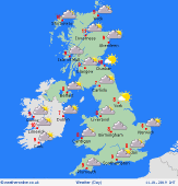
 For the weather for the next few days click here For the weather for the next few days click here
Wednesday 09/01/19
High pressure builds over Ireland once more but a weak trough will move from west to east across the northern half of the British Isles bringing rain to Northern Ireland, Scotland and the north of England. The heaviest rain will be in the west during the afternoon but light, patchy rain or showers will reach eastern parts of Scotland by the evening. There is a risk of some wintry showers in East Anglia and eastern England but elsewhere it should remain dry. Some bright or sunny spells for southern Wales and the southwest. Breezy for the Northern Isles. Highs near 3 to 7C.
 Thursday 10/01/19 Thursday 10/01/19
High pressure remains dominant on Thursday shifting eastward through the day. A weak front will bring patchy light rain and drizzle to England and Wales during the morning but most showers should ease off by lunchtime. The best of any brightness will be over eastern Scotland and northern England. Staying windy for the Northern Isles. High temperatures at 5 to 10C.
 Friday 11/01/19 Friday 11/01/19
Friday sees the area of high pressure shift slightly again to the southwest allowing low pressure to impact northern parts of the British Isles. After a bright start for many areas cloud will build from the northwest. Rain will move into Northern Ireland and Scotland through the afternoon with the heaviest bursts in the Western Isles and Shetland. Remaining windy for the northern part of the country. Highs at 7 to 10C.
Saturday 12/01/19
High pressure remains to the southwest while low pressure is to the northeast putting the British Isles in a cold northwesterly air flow. A band of rain will clear southern England during the morning before a second band of rain moves into northwestern Scotland by the late afternoon. Feeling cooler with highs at 5 to 10C.
Sunday 13/01/19
Sunday will be cloudy as low pressure passes to the north of Scotland. Rain for many areas with the heaviest bursts in areas exposed to northwesterly winds. Becoming increasingly patchy further south. Highs at 7 to 10C.
Monday 14/01/19
A further low pressure system moves in from the Atlantic on Monday. Wintry showers are possible for the Northern Isles ahead of this. Elsewhere will be cloudy, wet and windy. Highs at 8 to 11C.
|
