|
 Monday Monday
A weak front brings cloud and some scattered showers in England and Wales through Monday. There will be some brighter or sunny periods here too. Cloud and some showers across Ireland, northern England and Scotland too, those showers may merge into more persistent rain in places, particularly over northern Scotland. Feeling cooler for all with highs at 9C in northern Scotland, 17C in southern England.
 Monday Night Monday Night
A band of rain moves into southern parts of England and Wales through Monday night and into Tuesday morning. Some of this may be rather heavy. A cloudy night over southern parts of the UK then with cloud becoming patchier to the north with some clearer spells developing here. Overnight lows at 1 to 3C in the north and west, 5 to 9C under cloudier skies to the south.
 Tuesday Tuesday
A slack pressure flow across Ireland and the UK on Tuesday. Cloud and rain slowly moves north through Wales and England but tending to become lighter and more patchy. Northern England, Scotland and Ireland will have sunny spells, but some showers forming here, especially in Scotland and western Ireland. Highs at 9 or 10C in northern Scotland, 14 or 15C in southern England.
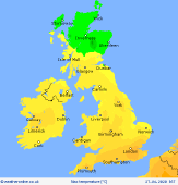
 Wednesday Wednesday
An area of low pressure may drift into Ireland and the southern UK on Wednesday. This brings cloud and periods of rain and showers with it, although the detail in the timing and amount of rainfall remain uncertain. Perhaps staying dry across much of Scotland with good spells of sunshine to the north. Temperatures at 8 to 15C, after an early patchy ground frost for some in the north.
|
