|
 Saturday Saturday
Mist and fog across central and southern England including Wales could be slow to clear in places during the day with some patches stubborn to lift at all. Drier and brighter away from mist and fog. Cloudier skies and patchy rain across Scotland, Ireland and Northern Ireland, snow towards higher ground across Scotland, though milder air moves in here on a south-westerly wind flow. Highs 4 to 9C, mildest in west, coolest in central and southeastern areas if it stays foggy.
 Saturday night Saturday night
Overnight, the cloud and patchy rain sink into parts of Wales and northern England, some snow over the higher ground. Clear skies across central, southern and southeast England where freezing fog will develop. Cold still across much of England into Wales with lows here dropping below freezing for many. Milder through Northern Ireland and Scotland with only a touch of frost in more rural places.
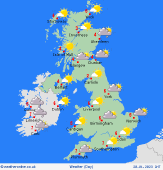
 Sunday Sunday
High pressure over south and east England keeps conditions dry but still on the chilly side here with extensive and dense fog for many. Southwesterly breezes in the north and west bring mild but damp and wet conditions with low cloud, patchy rain and drizzle pushing eastwards across Ireland, Northern Ireland and Scotland, before moving across Wales and Northern England during the afternoon. Highs 3 to 10C.
 Monday Monday
A chilly start, plenty of cloud, some lingering fog possible across southern and eastern parts of England. The north and west will continue cloudy, murky and damp within a southwesterly airflow, possible heavier rainfall across parts of western Scotland for a time. Highs 5 to 11C, coolest if in fog.
|
