|
 Monday Monday
A very warm and sunny day for most places as high pressure stays in charge on Monday. A weak front edging into western Scotland and Ireland may bring more high and middle level cloud in these areas, and perhaps a very isolated shower breaking out by the afternoon here too. Most places will stay dry all day. A general easterly breeze, feeling fresh near coasts at 15 to 17C. High temperatures at 19 to 23C inland.
 Monday night Monday night
Showers ease overnight before a band of rain edges into the far northwest and north of Scotland through the wee hours. A cloudier night over the northern half of the British Isles with clearer skies to the south. Overnight lows of 11 to 13C under the cloud to the north, more widely 7 to 10C.
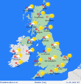
 Tuesday Tuesday
Most of England & Wales are dry with sunshine on Tuesday. Perhaps hazier in the north and west with high cloud. A front extending across Scotland and Ireland will bring more cloud overall here and outbreaks of rain. These may be locally heavy and thundery. Light east to northeast winds, feeling cool along North Sea coasts. Highs at just 11 to 13C in northern Scotland, 15 to 17C on eastern coasts, more widely at 19 to 25C.
 Wednesday Wednesday
High pressure located to the northwest maintains a general northeasterly breeze, strongest in the south. A weak front draped across the country brings more cloud and some patchy outbreaks of rain to northern and southwestern parts of England, Wales, southern Scotland, Northern Ireland and eastern Ireland. Accumulations will be small however. Temperatures at just 12 or 13C in northeast Scotland, more widely at 16 to 22C.
|
