|
 Friday Friday
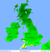
An unsettled day on Friday as weather systems move north and east across the British Isles. As they do so they will interact with cold air in place to lead to a risk of snow across N England and Scotland in particular and especially on higher ground. Some significant snowfall accumulations are possible here during the day. Elsewhere rain is more likely, with locally large totals in places. Relatively mild in the south, colder in the north. Highs 3C to 8C.
 Friday Night Friday Night
Rain, sleet and hill snow across northern areas clears with then clear spells allowing a cold night in the north along with some icy patches. Milder further south as further weather systems arrive from the south-west bringing additional rain, locally heavy rain too, as the night progresses. Lows -2C to 4C.
 Saturday Saturday
An unsettled day as wet and windy weather spreads eastwards through the day with locally heavy rain and showers across the north and west and perhaps still with some sleet or snow on higher ground of the north as well. Somewhat drier weather may follow, from the west, later in the night. Highs 4C to 10C.
 Sunday Sunday
Overnight wet weather clears away to the east during the morning and with then generally colder, showery conditions following from the west as the day progresses and these increasingly wintry across northern hills. A cold day in a blustery westerly wind, highs 3C to 7C.
|


