World
Africa
- Atlantic Ocean
- Central
- East
- Indian Ocean
- North
- » Algeria
- » Egypt
- » Libya
- » Morocco
- ⇓ Sudan
-
- Abu Hamad
- Abu na Ama
- Ad-Damazin
- Al-Fashir
- Atbara
- Babanusa
- Barah
- Dalang
- Dongola
- Ed Daein
- Ed Dueim
- El-Gadarif
- El-Obeid
- En Nahud
- Er Rahad
- Geneina
- Gereida
- Halfa El Gedida
- Kaduqli
- Karima
- Kassala
- Khartoum
- Kosti
- Nyala
- Port Sudan
- Rashad
- Renk
- Sennar
- Shendi
- Suakin
- Tandalti
- Tokar
- Umm Benin
- Umm Ruwaba
- Wadi Halfa
- Wad Madani
- Zalingei
- » Tunisia
- » Western Sahara
- Southern Africa
- West
Halfa El Gedida Weather
| Tu Apr 23 | We Apr 24 | Th Apr 25 | Fr Apr 26 | |
| Tmin 18-06 |
23°C | 25°C | 26°C | 26°C |
| Tmax 06-18 |
41°C | 42°C | 44°C | 44°C |
| morning 24-06 |
 |
 |
 |
 |
| a.m. 06-12 |
 |
 |
 |
 |
| p.m. 12-18 |
 |
 |
 |
 |
| evening 18-24 |
 |
 |
 |
 |
Last updated: Tue, 23 Apr, 10:39 CEST


| Nearby Forecast Locations - Halfa El Gedida | Distance |
| Kassala | 87.5 km |
In the next few days, it's mostly sunny.
Throughout the day it will be dry.
Daytime temperature reaches 43 degrees.
Forecast
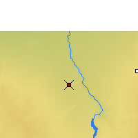
Halfa El Gedida
