|
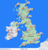
 Saturday Saturday
High pressure to the south brings a dry and bright day to much of England & Wales. Some sunshine, typically best in the east. A weak frontal zone affects the north-west, giving cloudy skies and patchy rain for Scotland and Northern Ireland, tending to drift south into Cumbria by afternoon, and giving some drizzly rain for west Wales. A south to south-westerly breeze, strongest in the north & west. Mild for all, highs 9 to 12C.
 Saturday night Saturday night
A weakening cold front slips south-eastwards overnight. Cloudy skies for many, and a few spots of rain or drizzle, mainly in western areas. Many places will stay dry. Some breaks in the cloud toward the east and south. A light west to south-westerly breeze, strongest in Scotland and near western coasts. Fairly mild, lowest temperatures 4 to 7C.
 Sunday Sunday
Dry and mild for most places all day. Partly cloudy skies, but some sunshine, generally best in east & southern regions. Risk of local spots of rain early morning, but should fade. Cloud thickens in the west as a warm front moves in from the Atlantic. Drizzly rain develops for western Scotland and Northern Ireland, becoming persistent here later. A westerly breeze, strongest in the north. Top temperatures 10 to 13C.
 Monday Monday
A brisk westerly breeze affects the British Isles, and a broad warm sector resides across the country. Low cloud and occasional rain for western coasts and hills - the rain most persistent in western Scotland. Meanwhile much of southern & eastern Britain should see broken cloud and sunshine. Risk of gusty winds in the north-east. Very mild, widely 13 or 14C, but locally 15 or 16C to the lee of high ground in the east.
|
