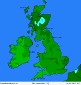
|
 Friday Friday
A strong area of high pressure over Scandinavia produces a bitterly cold easterly wind across the British Isles. Cloudy skies overall, although western areas to the lee of high ground should see some sun. Largely dry, but light sleet or snow showers will drift into eastern counties - some may spread well inland. Risk of local shower bands also clipping south Devon. Temperatures just 2 or 3C for most; around 6C in the south-west.
 Friday night Friday night
Snow showers continue to affect eastern regions, extending inland across the Midlands, and may become increasingly persistent - risk of moderate snowfall for several hours where showers band together. The North York Moors, eastern Pennines and perhaps Scottish Borders are most prone to a good covering of snow. Temperatures near 0C for most, but where skies clear in the west, risk -3 to -5C, or much lower in some Highland glens.
 Saturday Saturday
Showers will feed inland from the North Sea, locally resulting in frequent precipitation - falling as snow for many inland areas, giving several centimetres over higher ground, and a dusting at low levels. Risk of a snow flurry almost anywhere. Mostly rain on the coast. Cloudy overall, some brightness toward the west. A brisk north-easterly wind, feeling bitterly cold. Just 2 to 4C for most, up to 6C in the south-west.
 Sunday Sunday
A cold and brisk easterly wind affects the British Isles, giving a significant wind chill factor, particularly in the south & east. A lot of cloud, and local drizzly showers or snow flurries, although amounts small. Some brightness to the lee of high ground in the west, generally best in western Scotland & Northern Ireland. Top temperatures 2 to 5C, but feeling sub-zero in the wind.
|
